| Slovakia Genealogy Research Strategies | ||||||
| Home | Strategy | Place Names | Churches | Census | History | Culture |
| TOOLBOX | Contents | Settlements | Maps | FHL Resources | Military | Correspondence |
| Library | Search | Dukla Pass | ||||
Military History - Northeast Slovakia
1944 Annotated Soviet Battle Maps & Topographical Maps
for
Eastern Czechoslovakia (Slovakia) including Dukla Pass
Dukla Pass 1944 Overview | Post-Dukla Military Operations
1939 Hungary Annexation | Military Records / Archives | General Maps | WWII Battle Maps
Much material is available on the Military History of this region at a macro level and will not be repeated herein. What is lacking are English-language documentation of local military operations, especially as they involved the local citizens. This section is limited to unique accounts, materials and local research not found elsewhere.
Local (Northeast Slovakia) Operations
1939 Annexation of East Slovakia by Hungary
1944 Battle of Dukla Pass Overview
ANNOTATED SOVIET MAPS OF DUKLA PASS & EAST SLOVAKIA BATTLES
| Table 1: Battle Maps | ||
| Battle Map Title & Link to Original Map (courtesy of armchairgeneral.com) | English Translation / Annotated Map | Description |
| Operations in Carpathian Mountains Sept-Nov 1944 Map 1 |
 | High-level Soviet offensive into Czechoslovakia from Poland and Ukraine extending roughly from Stara Lubota southward across the Carpathian Mountain ridge to Uzhorod, Ukraine. Shows major Corps and Brigade troops. Does not illustrate frontline dates. |
| Operational Combat for the Dukla Pass Sep. 08 - Oct. 28, 1944 Map 2 |
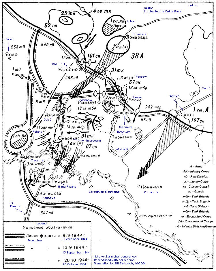 | Mid-level detail of Dukla Pass operation, illustrating progression over three frontline dates. Includes movement of tank brigades from Krosno Poland region, southward. Fighting through heavily fortified Krosno-Sanok-Dukla region, ending with the immediate crossing of the Carpathian Mt. ridge only as far south as Kalinov. |
| Dukla
Offensive Strategy of the 1st Guards Army
September 06, 1944 Map 3 |
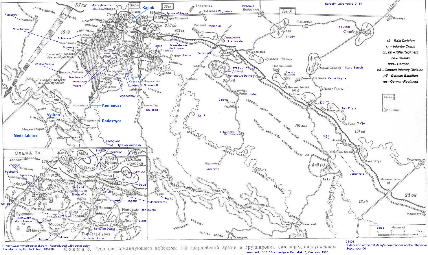 | The Soviet offensive plan to attack German Dukla defenses southward from Sanok, Poland. Illustrates the major fortifications. Includes Medzilaborce - Sanok southward to Uzhorod-Turka, Ukraine, generally following the Carpathian Mt. Ridge. Includes much detail of the intricate German fortifications south of Sanok. (Does not portray troop movement over time.)
|
Operations of the 1st Guards Army through Poland to the Carpathian Mountains Sept 9-30, 1944Map 4 |
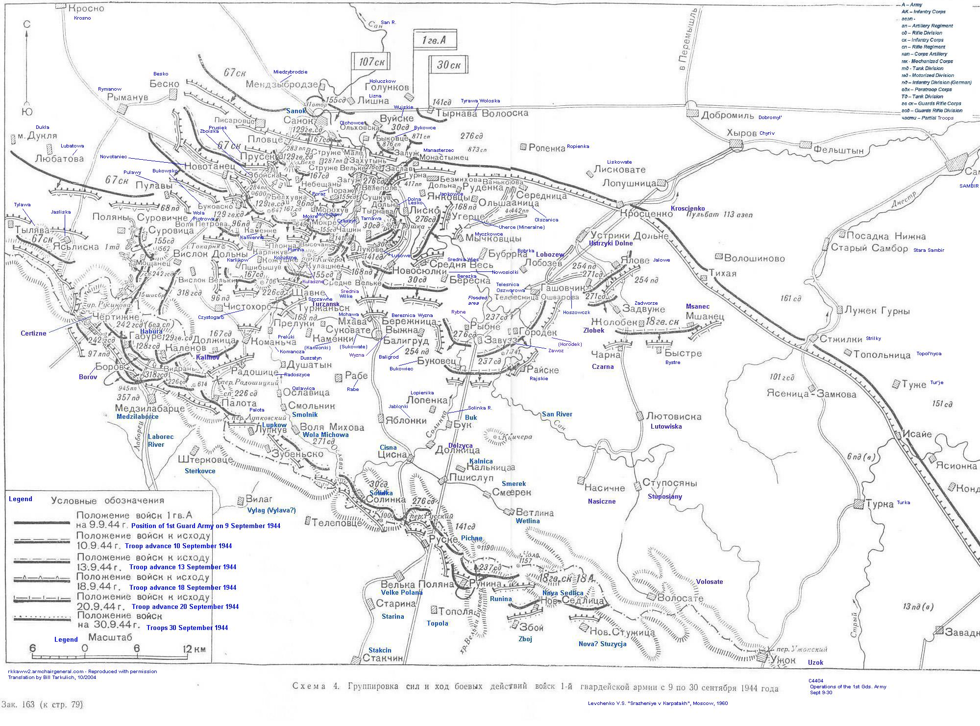 | Illustrates the progression of Soviet troops through the heavily fortified region South of Sanok-Ustryki-Dolne, Poland to the Carpathian Mountain ridge (Certizne-Nova Sedlica.) Progression is charted over six dates. German fortifications shown in great detail. Integrated foot soldier and tank movements. An operational description of the plan shown in Map 3. |
| Operations:
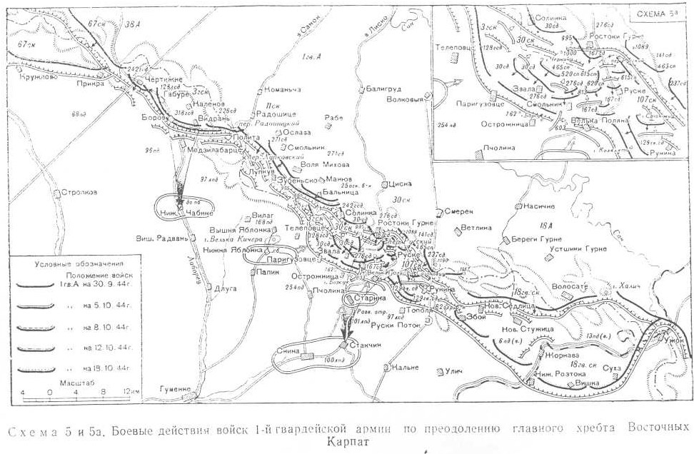
Crossing the Main Carpathian Mountain Ridge by the Troops of the First Guards Army Sept 30 - Oct 18, 1944 Map 5 |
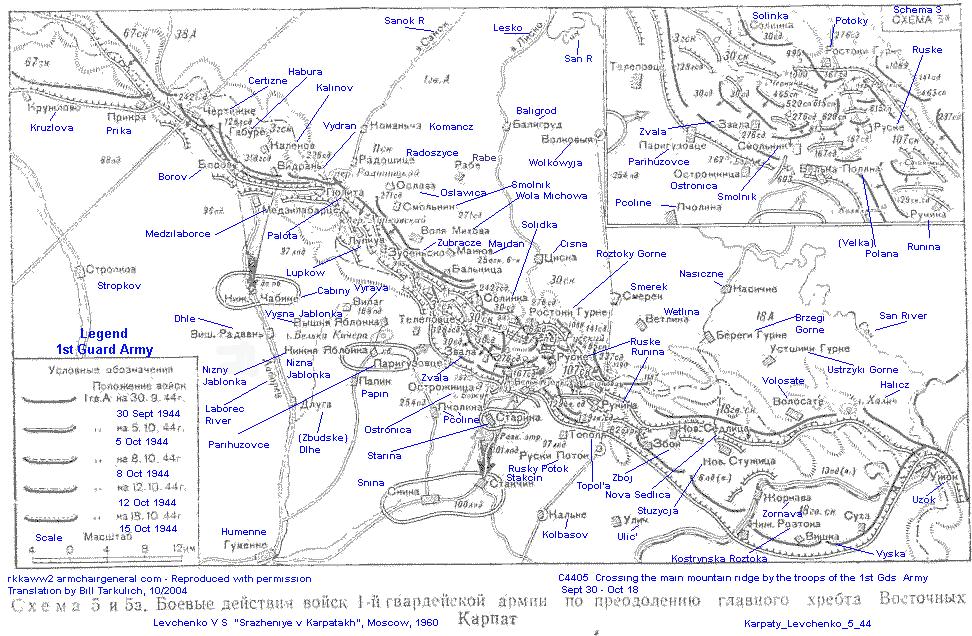 | A fairly detailed description of the German fortifications and Soviet operations along the Carpathian Mountain Ridge. Extends from just north of Dukla Pass, through Runina, ending at Uzok, the most southerly point. Illustrates five specific front line dates. Map quality is marginal. |
| Operations:
Evolution of the offensive of the 1st Gds Army along the Hungarian plain and reaching to the Ondava river line. Nov. 23-30, 1944 Map 6 |
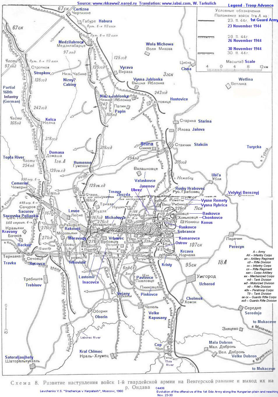 | The westward Soviet offense from Ukraine into Czechoslovakia. Starting East from Cisna Poland south - Cop, Ukraine, then progressing westward to include just west of Humenne in the north and Trebisov, Slovakia -Satoraljaujhely, Hungary in the south. Details of the Sobrance-Michalovce fortifications and advances. Illustrates three frontline dates. |
Operations: Soviet offensive across the Carpathians, in the Ruske (Czechoslovakia) region October 3-11, 1944 Map 7 |
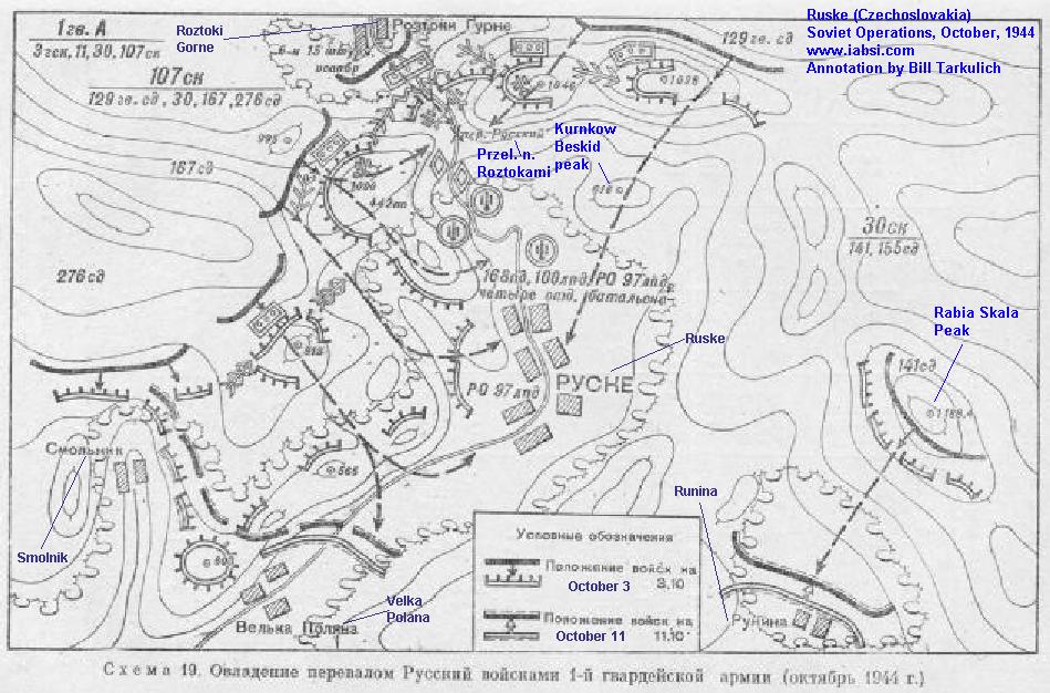 | Soviet Army thrust from the Carpathian Mountain ridge (from Roztoki Gorne (Poland) to Rabia Skala peaks, southward to the villages of Velka Polana and Runina. Small villages in the valleys, easily defended wooded mountain terrain.
Several villages in this region (Ruske, Velka Polana) have been depopulated to accommodate a drinking water reservoir in Starina. Map quality is marginal. |
| Operations: 1944 Zakarpatska region Soviet offensive thrust from Carpathians toward Uzhorord October 20-25, 1944 Map 8 |
 | Soviet Army thrust from the Carpathian Mountain ridge (from Kremenic peak south). Southerly movement from fringes of today's Slovakia and western Ukraine, towards (Velky) Bereznja, with the forward objective of Uzhorod. Operations take place in moderately rugged, wooded mountains which are easily defended. In the valley are small villages (approx 70 to 120 houses per village.) Many houses are burned by the retreating German troops. Map quality is marginal. |
| The above maps are reproduced and annotated by permission of Alex at Armchair General, where a fairly broad set of WWII Soviet-authored maps can be found. | ||
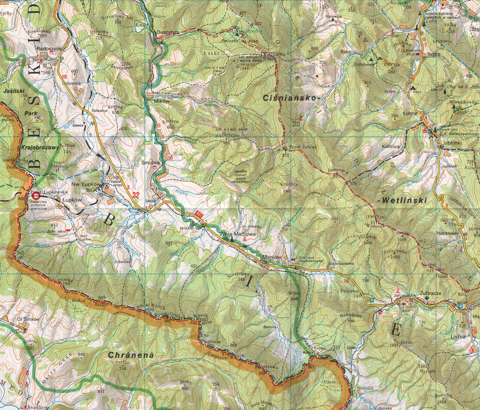
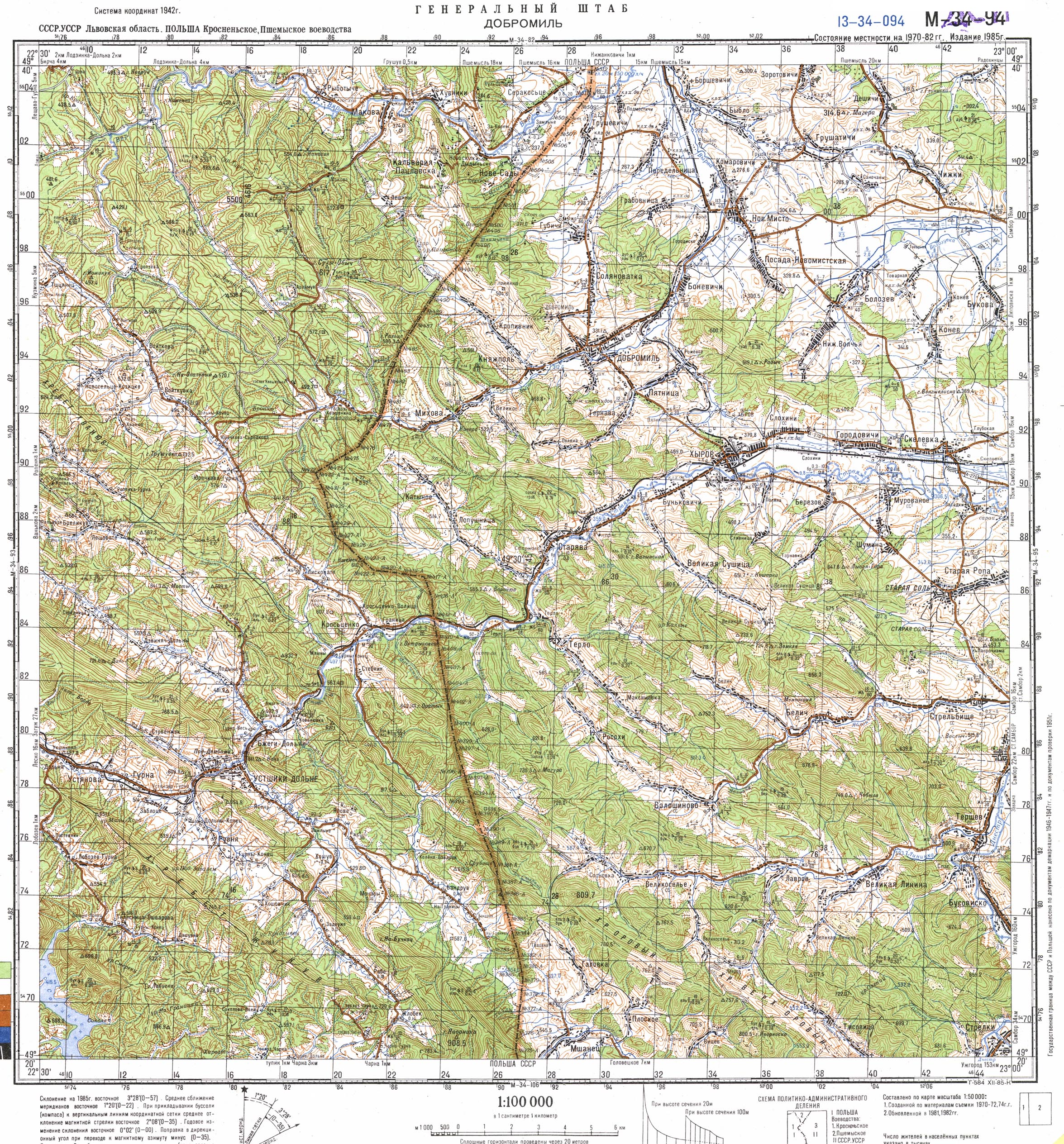
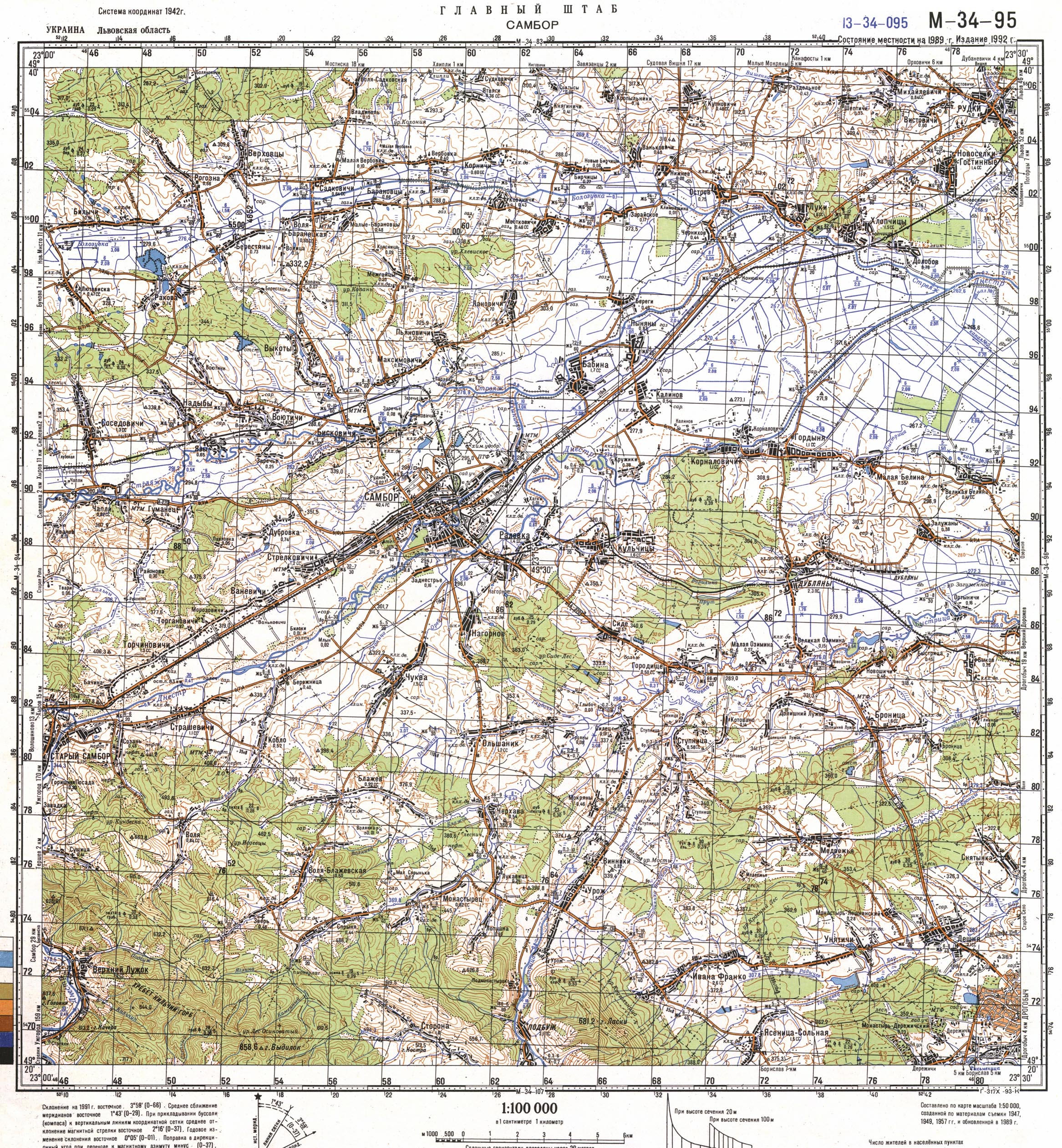
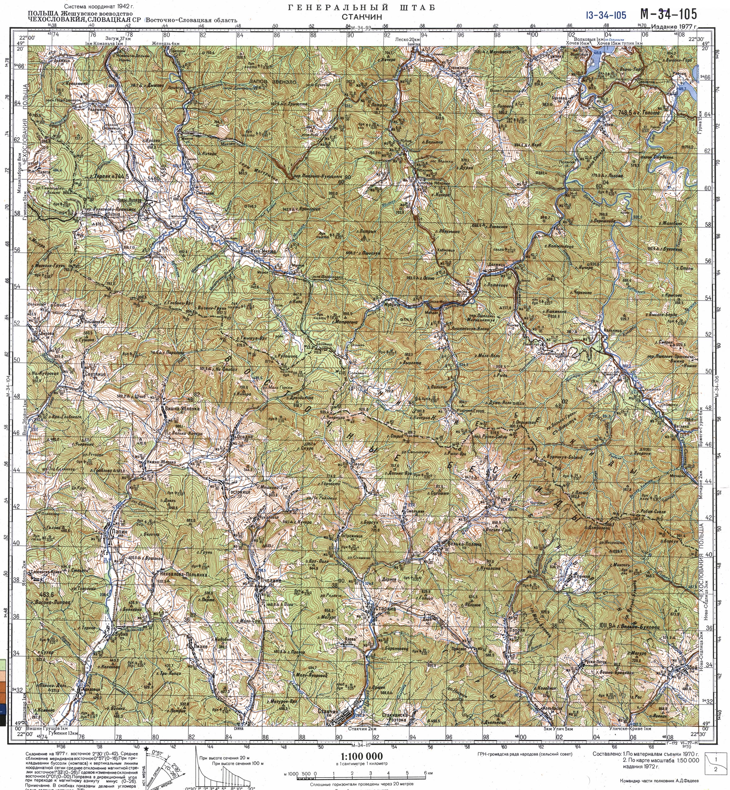
In order to get your bearing, see some topographical detail and what has changed in the intervening years, I've included a couple of topographical map references below. Map 6 generally illustrate the lands of Southern Poland, and northern fringes of then-Slovakia, which saw a good deal of the Dukla battle, even before it reached the Dukla Pass. Map 7 Generally shows western Ukraine and the eastern fringes of then-Slovakia. Clicking on each map sector thumbnail will take you to a full-size map page.
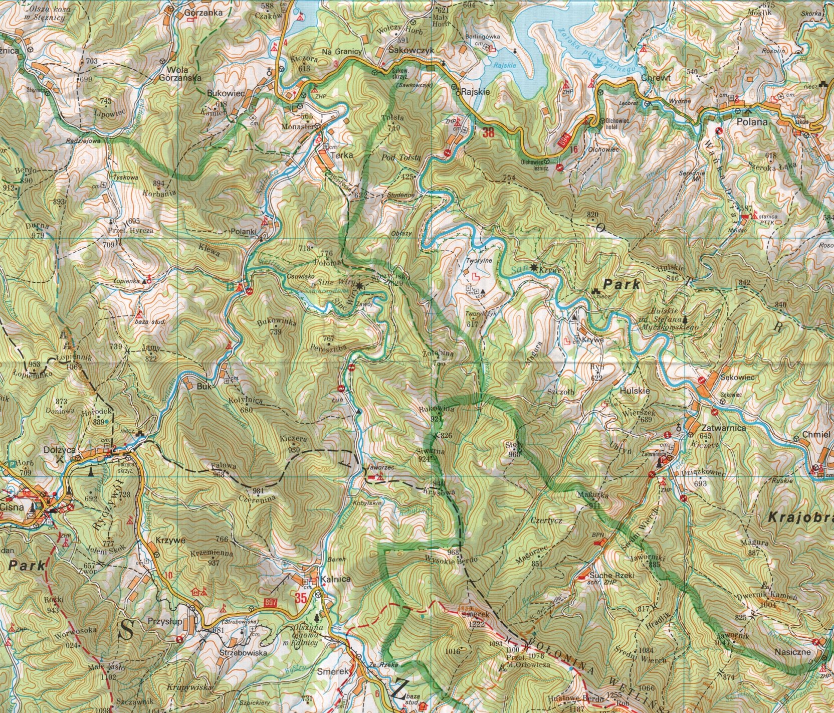
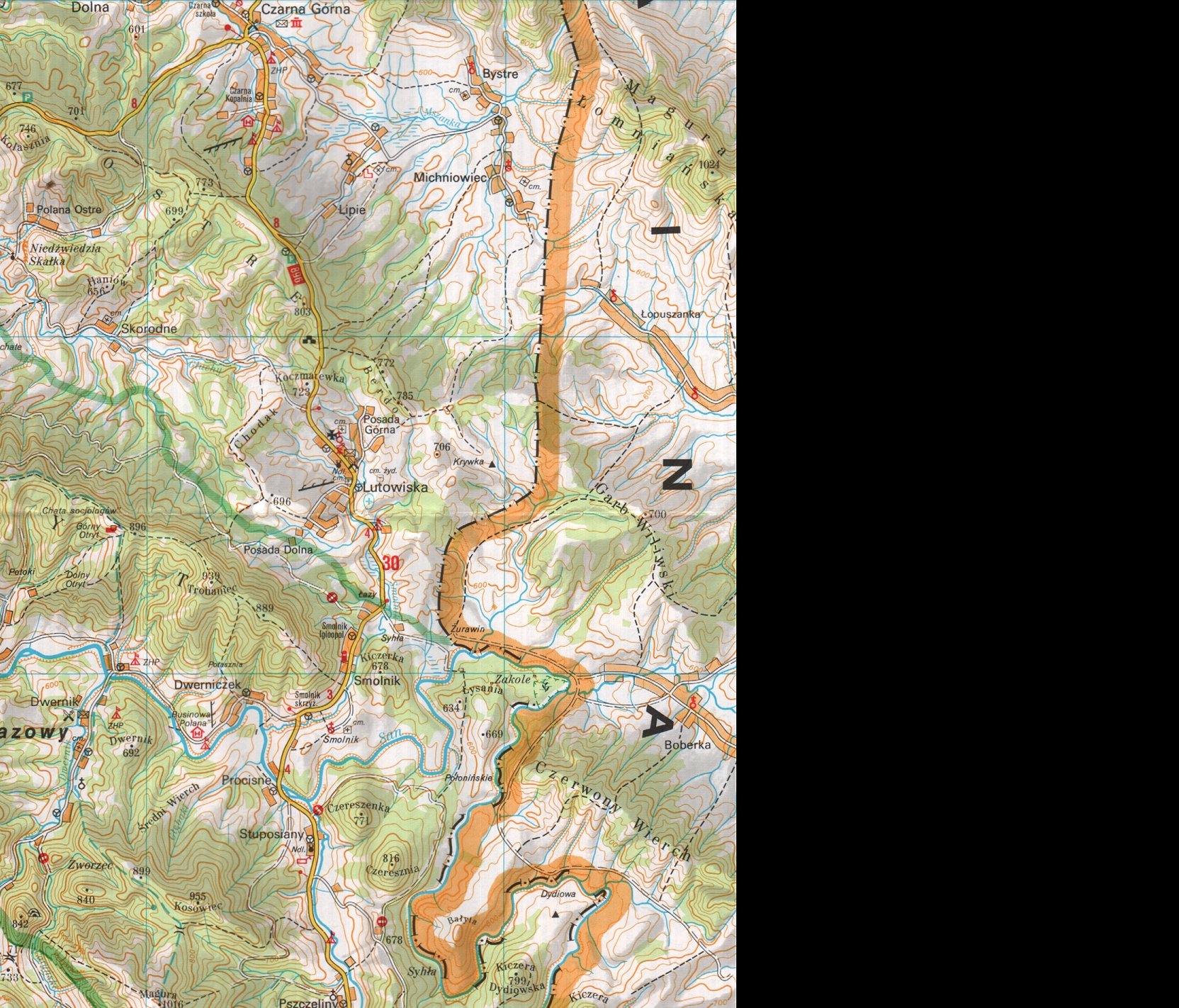
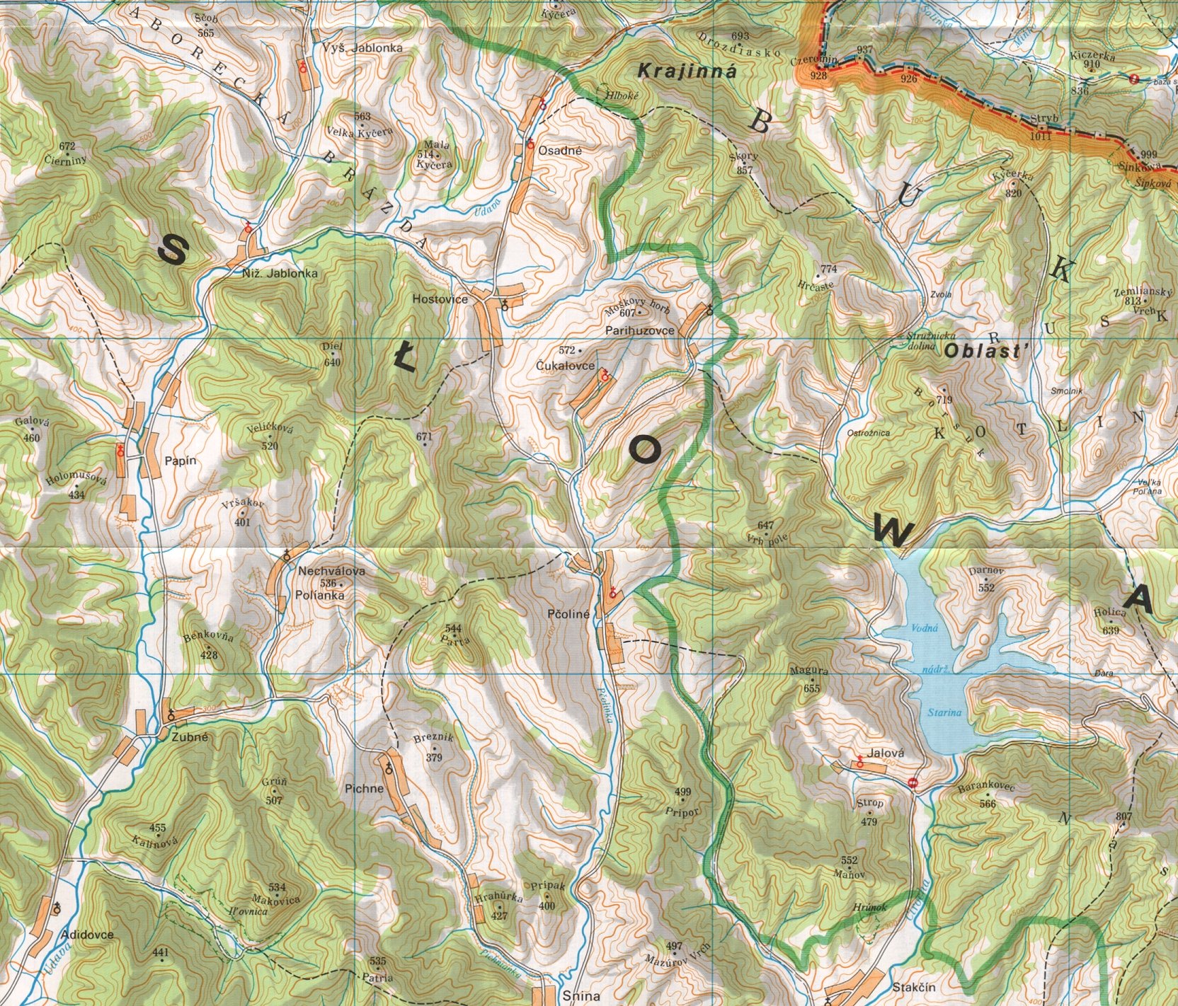
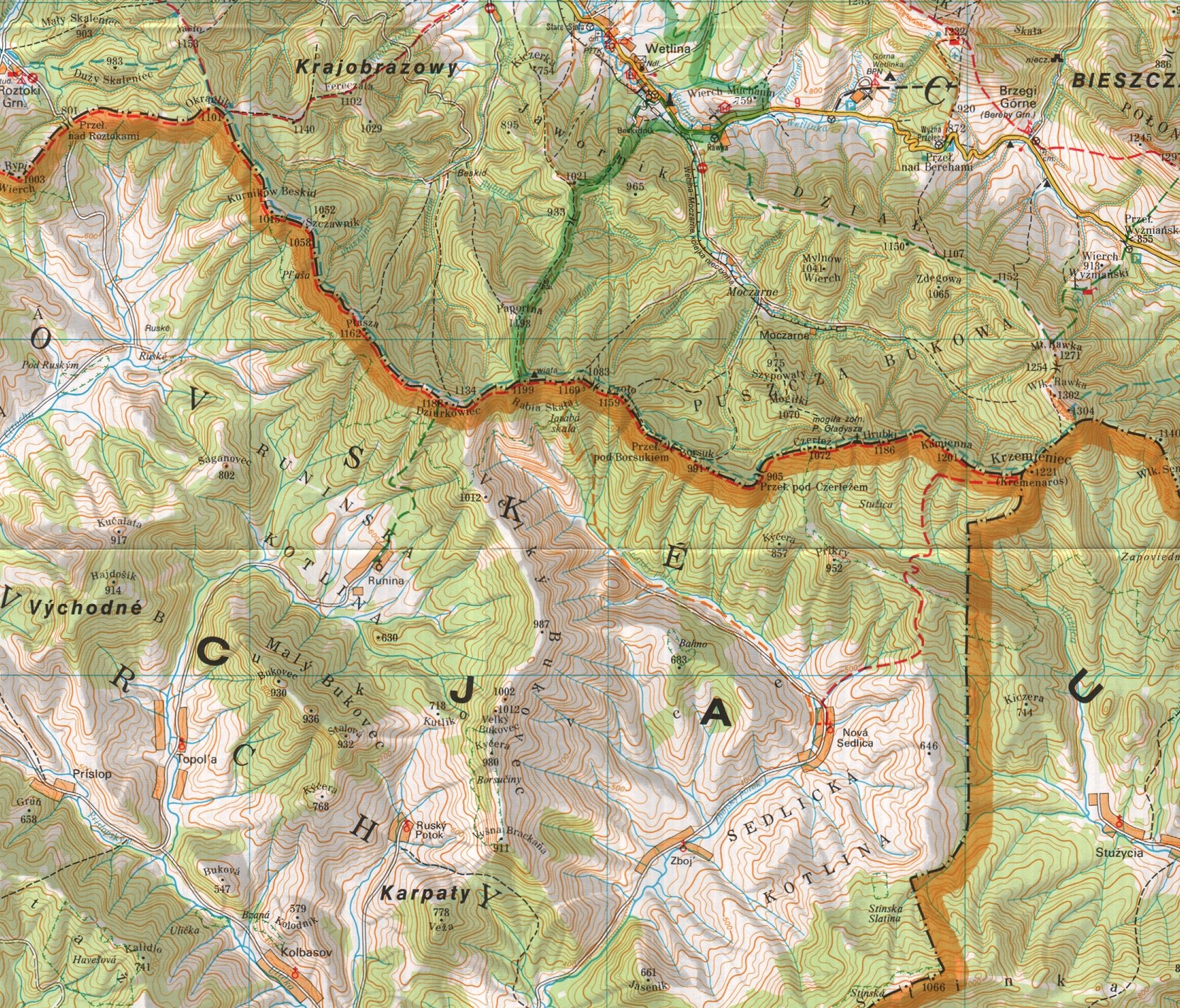
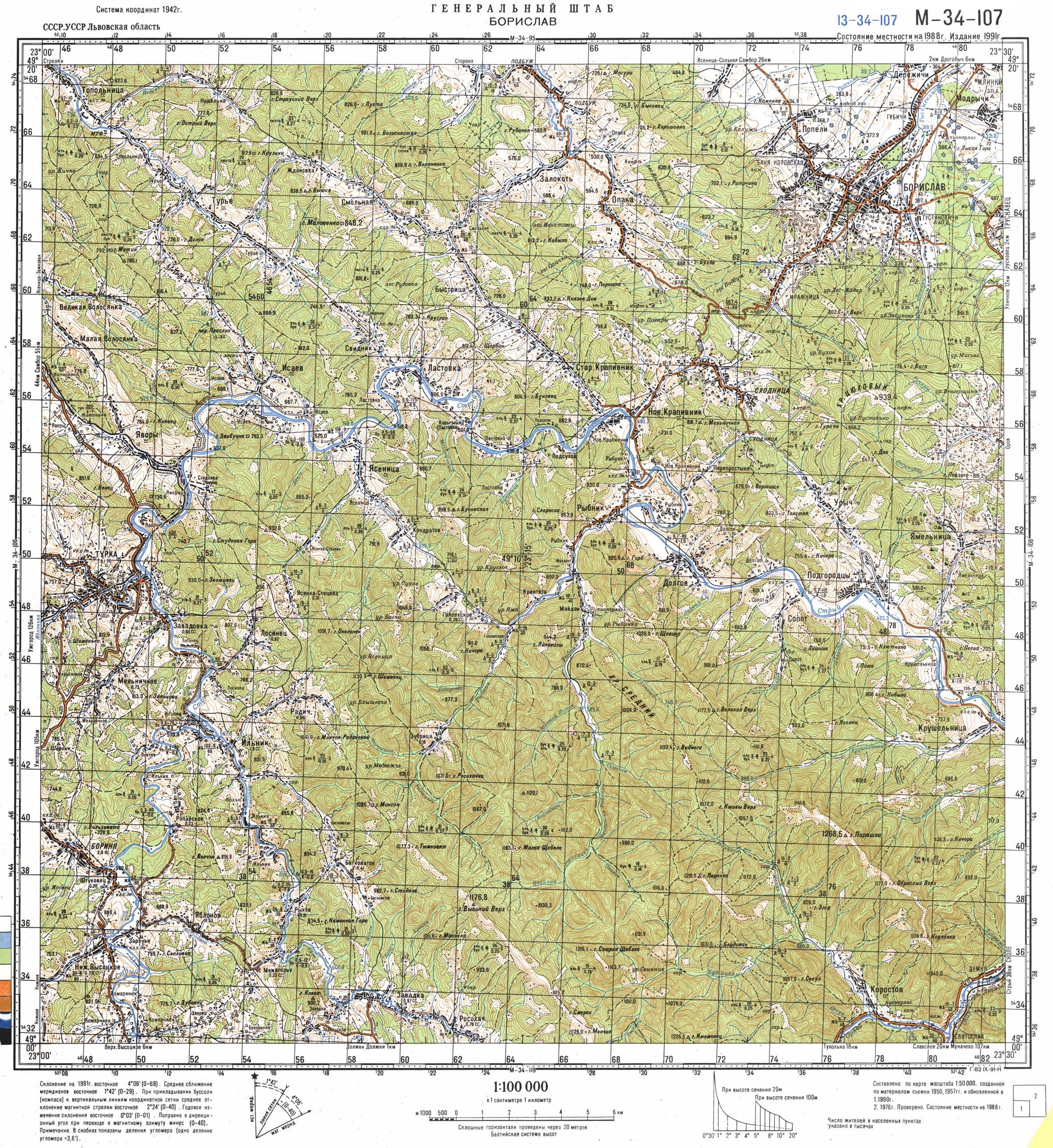
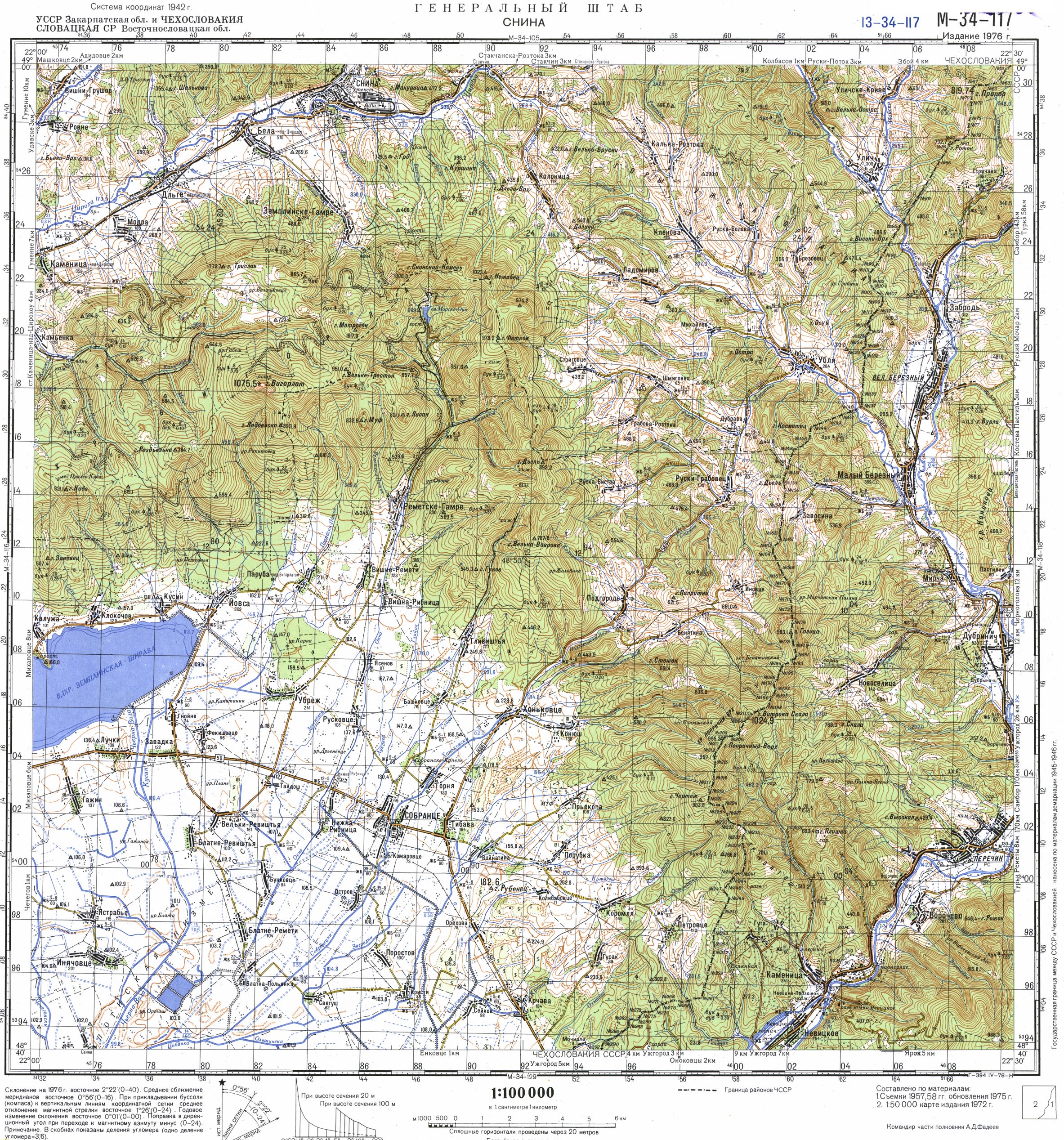
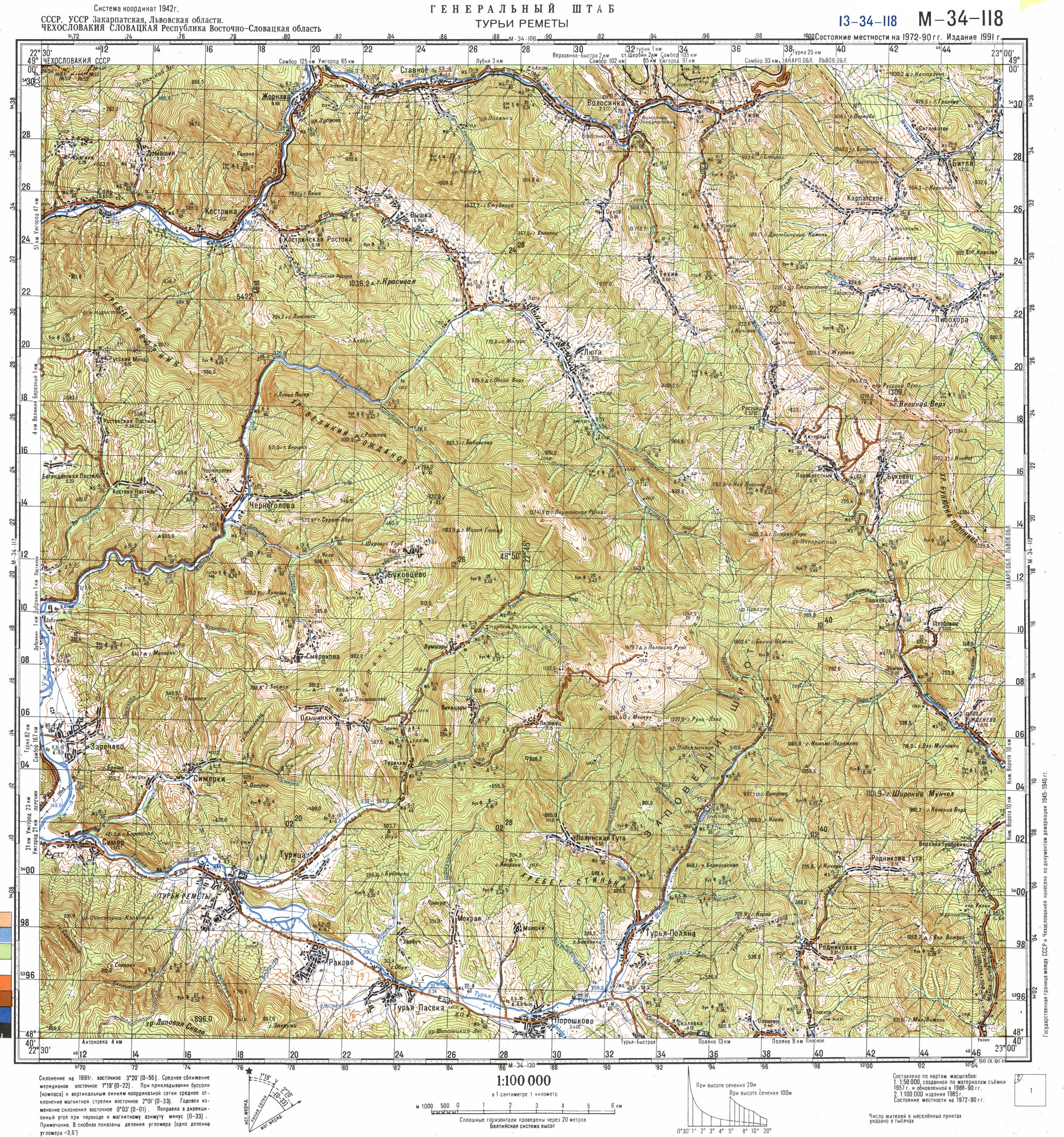
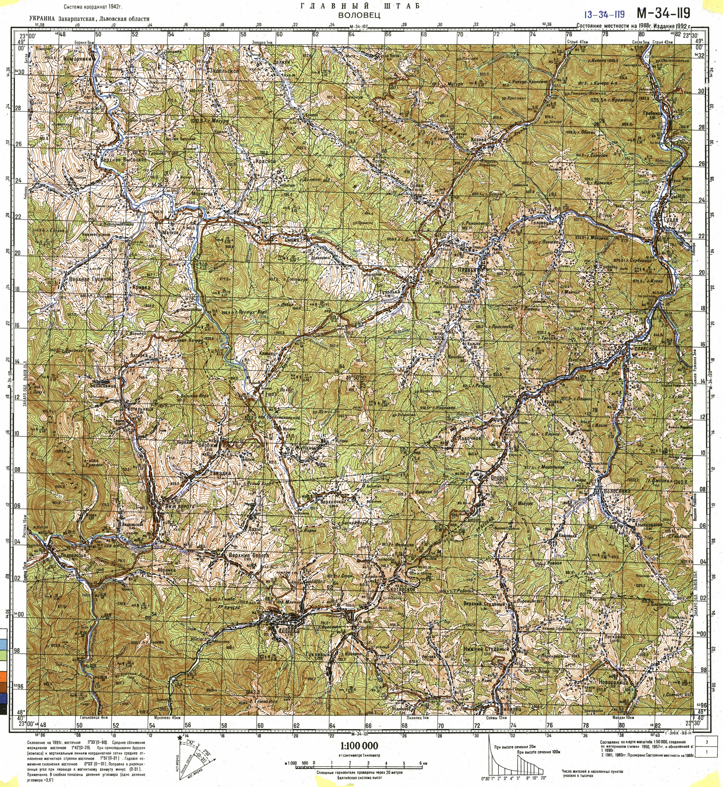
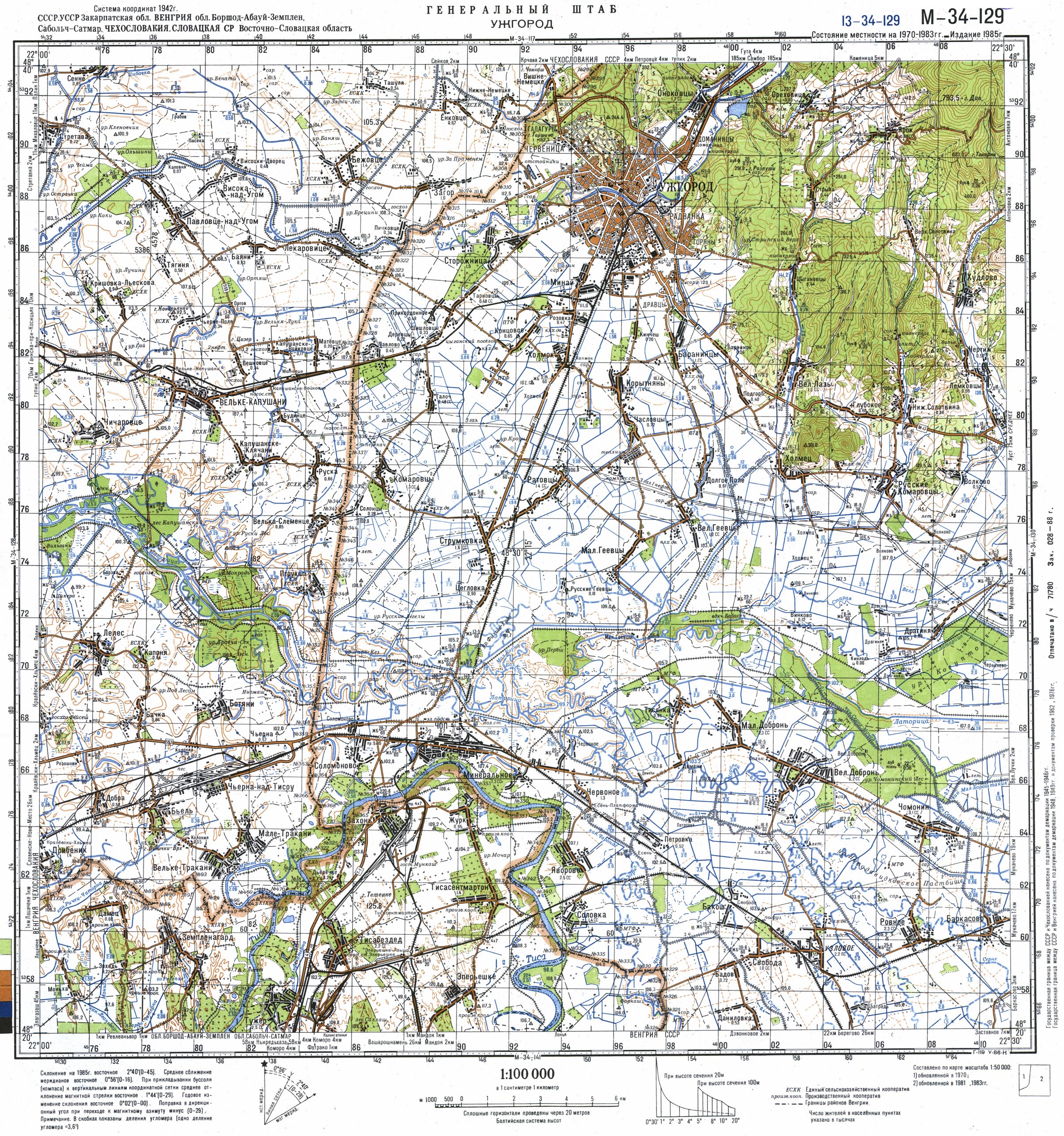
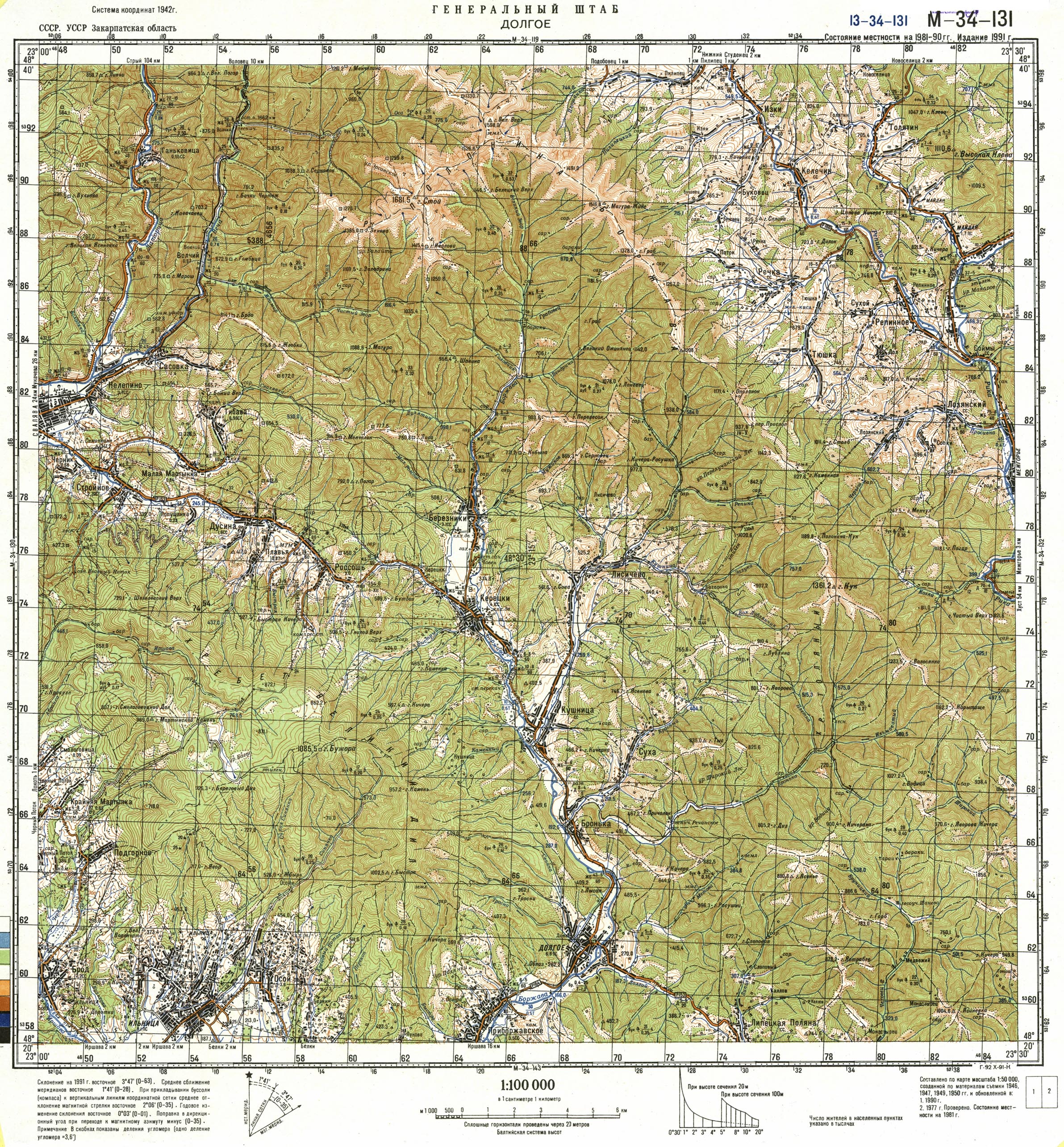
Map 9: Topographical Map: South-east (Bieszczady) and North-east Slovakia | ||
 |
 |
b03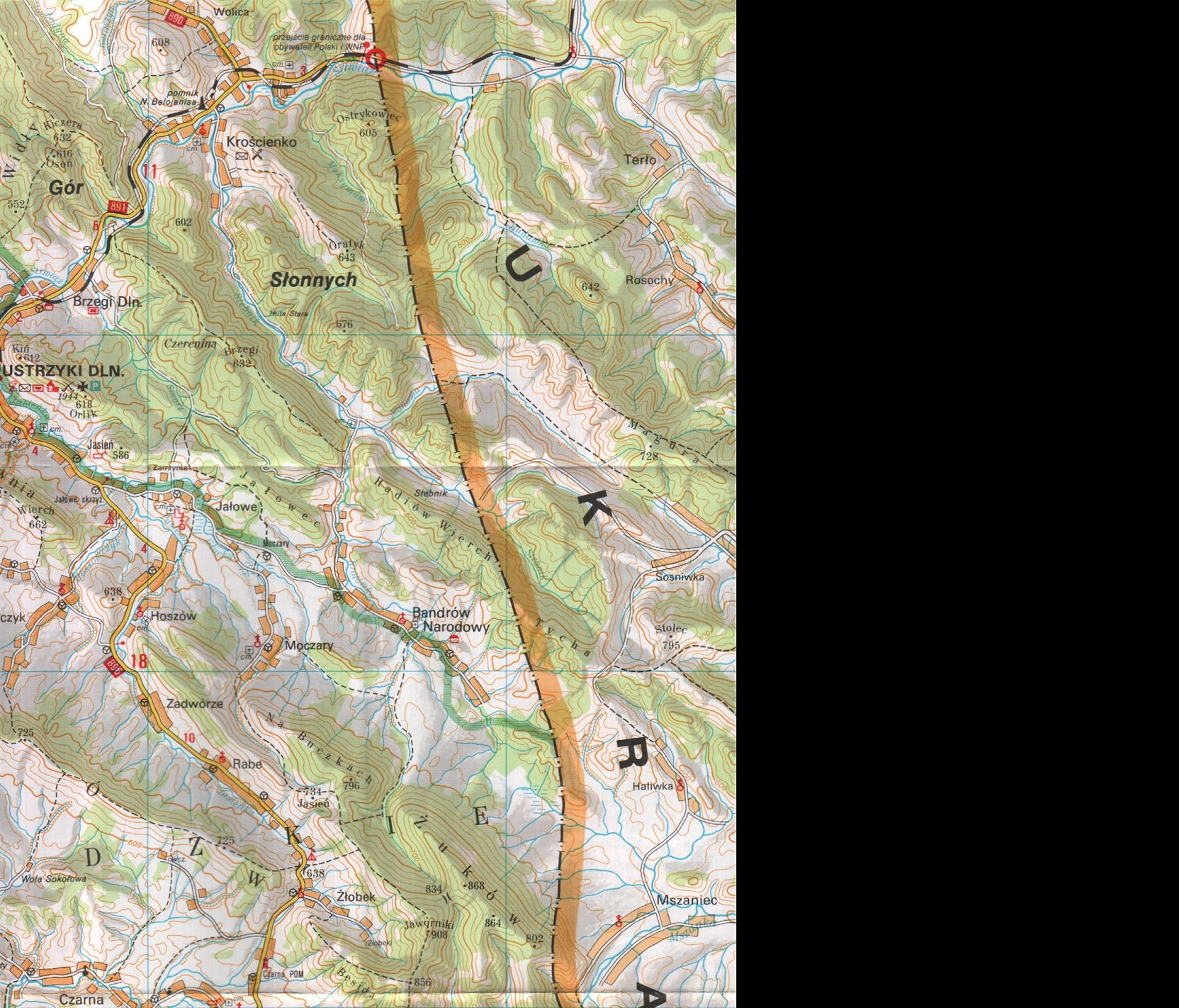 |
 |
 |
 |
 |
 |
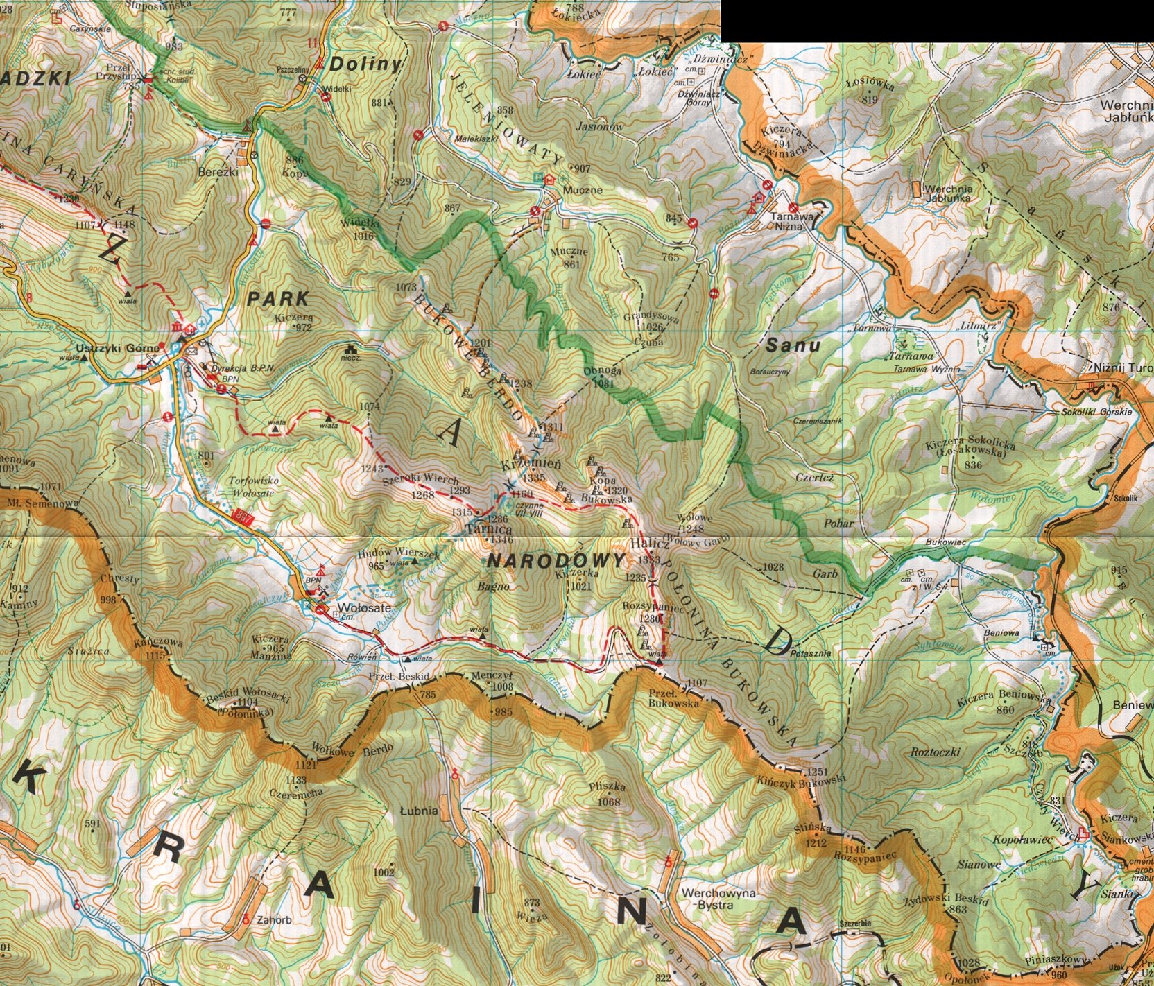 |
The above 9 map topographical map sectors are shown above. This shows South-east (Bieszczady) and North-east Slovakia, encompassing a good section of the battle portrayed by the battle maps. Clicking on each of the 9 sectors will expand that particular sector. These enlarged maps range from 785K to 907K each in size.


1944-1945 Russian Offensive, Post-Dukla
RELATED MATERIAL
1938-1945 World War II European Battle Maps, US Military Academy (offsite)
Battle Maps Related to Operations In/Near Eastern Slovakia (produced by US Military) (offsite)
These maps illustrate troop operational positions for all of Europe at a high-level. They describe Army-divisions and front lines.
Campaign in Poland. 31 August 1939 (offsite)
Campaign in Poland, 1 September 1939 (offsite)
Links to off-site webs will open in a new window. Please disable your pop-up stopper.
Last Update: 15 November 2020 Copyright © 2003-2021, Bill Tarkulich